Geographic accessibility analysis
Method development and applications
During a ten-year period, we have been involved in projects in the field of geographic accessibility analysis. This involves for example analysis of the amount of time or distance required to reach service or other places of interest. This research has both addressed general method development and applications.
Projects
National evaluation of geographic accessibility
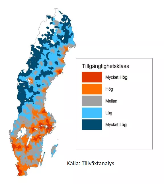
In this project, we work as a scientific adviser to the Swedish National AgencyTillväxteverket, which has a national responsibility for monitoring geographic accessibility. Areas of application include monitoring of how accessibility are influenced by policy decisions and / or social development as well as the structural component of the municipal tax equalization system.
Together with traffic researchers at LTH, VTI and K2, we work in a Vinnova project to study what can increase the proportion of trips by bike where geographic availability is an essential part. The project is in collaboration with Growth Analysis, which is also the financier.
Contact information
Lars Harrie
Email: lars [dot] harrie [at] nateko [dot] lu [dot] se (lars[dot]harrie[at]nateko[dot]lu[dot]se)