Geographical Information Science
Spatial analysis has always existed and will always exist. Humans have a need to orient themselves in their surroundings, for example by using maps as well as investigating and predicting how the world changes over time. Through increased use of computers, the use of digital spatial analysis has increased dramatically.
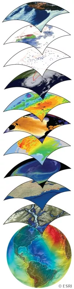
Tools and techniques for geographical data
Maps are now stored in computers and new advanced map analyses can be carried out relatively easily. Geographic Information Systems (GIS) has become a quite well-known term in the last few decades. GIS is a collection of tools and techniques by which computers are used to collect, store, analyze and visualize maps and other geographical data.
Spatial analysis
Research in spatial analysis aims at developing and applying geographic information processing and GIS. Development can for example focus on creating tools for storage, distribution, analyses and visualization of geographic data, while applications could be analysis of a variety of phenomena. The Department and the GIS Center conduct research that includes spatial analysis in several subjects, such as climate and environment, the built-up environment and epidemiology / demography. In the field of the climate and environment we have for a long time studied hydrological, topographic and carbon modeling.
Digitization of data in interdisciplinary data
We are active in several projects relating to the ongoing digitization. The questions concern for example how geographic data should be organized, shared and analyzed to facilitate the planning, construction and management of the built-up environment. In epidemiology and demography we collaborate with other research groups, mainly at Lund University. These interdisciplinary projects aim at developing and applying methods for studying how the environment affect people both historically and today. Our research groups are also involved in the ICOS Carbon Portal, ivolved in european monitoring of climate data.
International collaboration with special focus on developing countries
We are working internationally, and especially in developing countries. Examples of projects are effects of climate change and migration in Uganda, studies of floods in Mozambique, and analysis of coal in soil and waterways in Rwanda.
Educational development and capacity building
Another type of GIS-related project at the department and the GIS center deals with educational development and capacity building. Together with partners from Europe, the Middle East and Africa, we are developing pedagogy in both campus-based and online-based GIS education. Course content and communication between teachers and students are studied and improved in collaboration with educational experts. Further, brand new GIS courses and programs are being built.