Tourism environmental impact and spatial planning
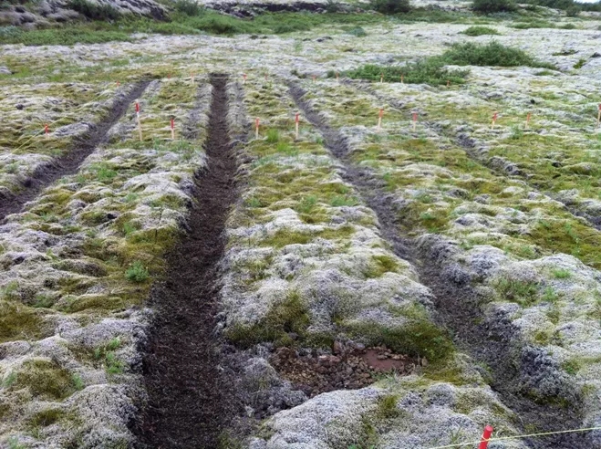
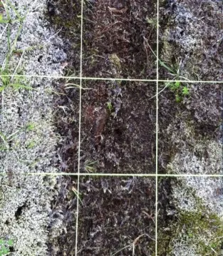
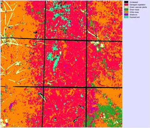
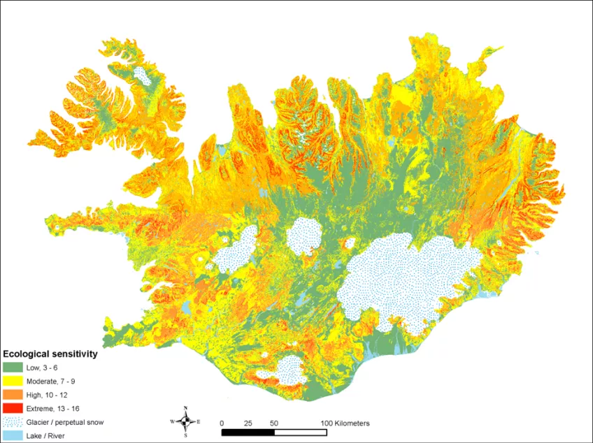
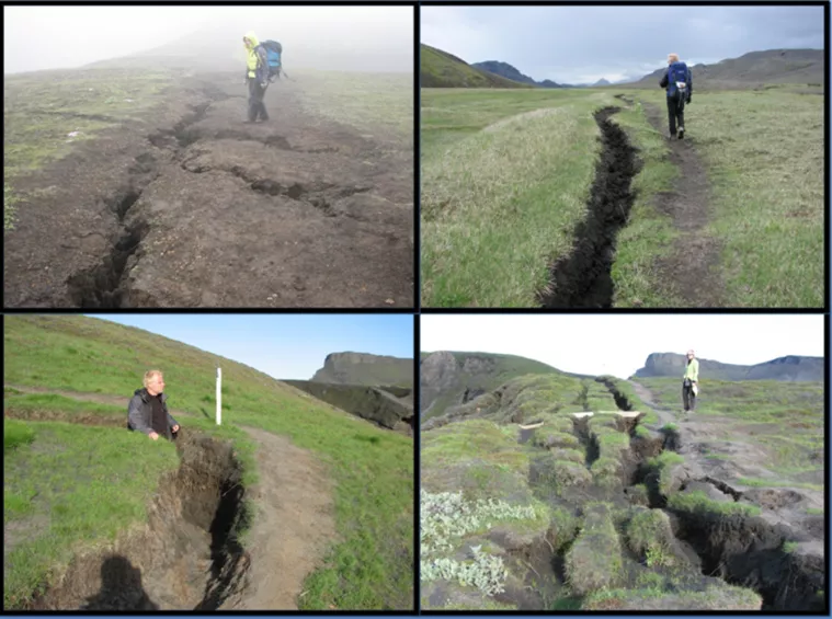
Tourism may cause pressure in vulnerable areas
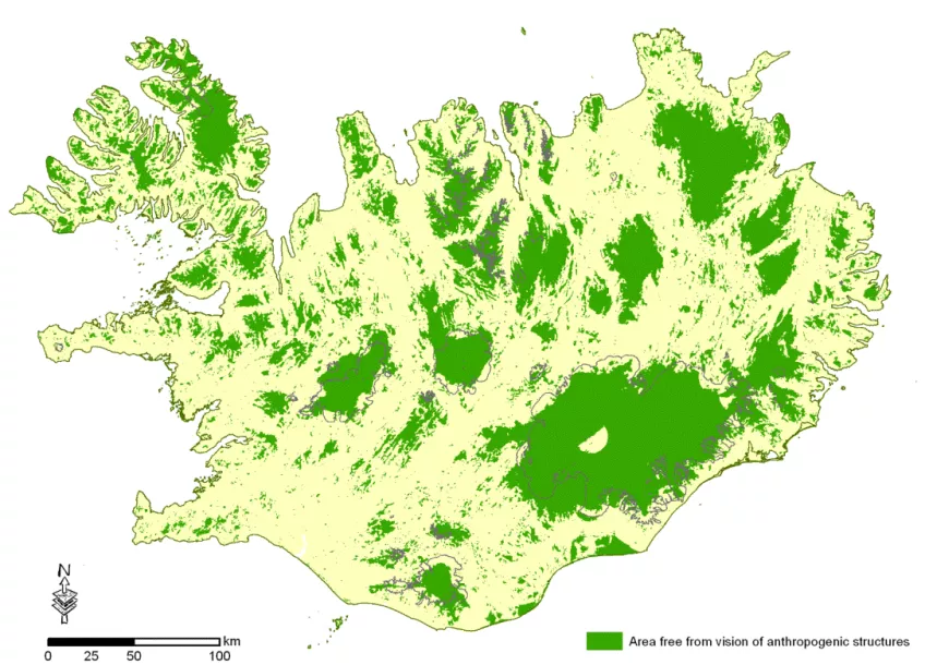
During the past decades tourism has grown to be the world’s fastest growing economic sector and is now seen by the UN World Tourism Organization as a key driver for socio-economic progress and development. Thus new destinations are sprouting which attract increasing number of tourists to visit remote destinations that earlier that ehad limited accessibility and no tourism infrastructure. This development pushes tourism into marginal and vulnerable areas increasing social, economic, and environmental pressure from tourism. Hence, many attractive natural and wilderness areas face the risk of becoming overexposed due to increased pressures from tourism-related development driven by increasing visitor numbers. In vulnerable areas this development furthermore greatly affects these areas biodiversity and geodiversity and may eventually cause unrepairable damage to the very attractiveness they possess.
GIS and remote sensing tools
Understanding the spatial dynamics of tourism has never been more important in order to increase the positive effect of tourism and decrease the negative ones. GIS in combination with remotely sensed (RS) data, such as aerial photographs and satellite multi-spectral images, are important tools in monitoring and delineating areas of specific value or sensitivity. GIS and RS are furthermore critical tools for analyzing and mapping the status and change in the environment in order to holistically plan and manage a natural area tourist destination for a sustainable future as regard tourism pressure and climate change.
The research is done in collaboration with the Faculty of Life and Environmental Sciences, School of Engineering and Natural Sciences, University of Iceland.