Techniques for and consequences of using INSPIRE extensions
Harmonisation of geographic data
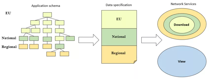
Harmonisation of geographic data, as part of the creation of a Spatial Data Infrastructure (SDI), has become more and more widespread in recent years. This goes for several geographic levels: European, national and municipal. The INSPIRE Directive is one of the main driving forces, especially for the SDI development at the European level, but it also has substantial influence on the development on other levels.
Demand for easily available geographic information
As the common knowledge about SDIs is growing and the demand for easily available geographic information is increasing in society, many countries now see the need to also provide more detailed information at the national level. One of the options to do so is to extend the INSPIRE data specification to also include the more detailed and specific national information.
Our work in this project
The purpose of this project is to
- study the techniques for creating formal extensions of INSPIRE specifications and
- evaluate the consequences of using an extended INSPIRE network service (that builds on the extended specification), instead of having separate INSPIRE and national services.
In the study, the INSPIRE Hydrography (HY) UML model have been extended with all information from Swedish Water System Standard (SWSS). SWSS is used to get detailed and complex user requirements of information needs at the national level. This evaluates if complex extensions with many new classes, attributes and relations between classes can be made. The UML model is transformed to an XSD Schema, data is mapped to this and GML-files are created.
Evaluation
The evaluation consists of three parts: a quantitative evaluation where the number of attributes, structure, file size etc. of the GML files is compared, a user-centric usability study performed as a test case, and a data provider-centric study performed as interviews.
Contact person
Helen Eriksson, Industry PhD student employed at Lantmäterie
Email: helen [dot] eriksson [at] lm [dot] se (helen[dot]eriksson[at]lm[dot]se)