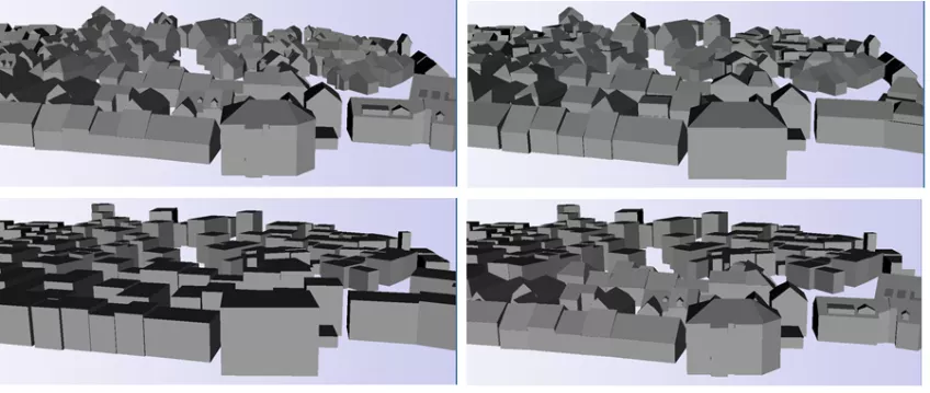
Visualization of 3D city models
3D city models can improve many applications such as urban planning, navigation, disaster management and traffic control. An increasing number of applications start to integrate 3D city models into their platforms. This development is based on: (1) improved techniques for creating 3D buildings using remote sense techniques such as Lidar and photogrammetry, and (2) the development of stationary and mobile devices that can access 3D city models. However, compared with the data volume and complexity of 3D city models, the capability of devices and network band are still limited. To improve the visualisation efficiency, generalisation of 3D city models is required. In this project we develop and implement generalisation and visualisation methods of 3D city models to make this type of models more accessible for applications on foremost mobile devices. The studies incorporates geometric simplification of models as well as how emerging technologies such as X3D and HTML5 can be used for the visualisation.
Contact information
Lars Harrie
Email: lars [dot] harrie [at] nateko [dot] lu [dot] se (lars[dot]harrie[at]nateko[dot]lu[dot]se)