The publication can be found at: http://www.nature.com/articles/sdata201746, and author information is available at: Finn Hedefalk, Patrick Svensson and Lars Harrie.
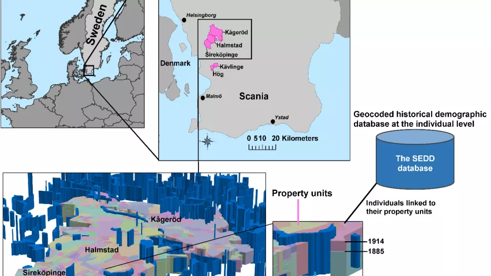
The datasets provide a detailed spatio-temporal description of five Swedish rural parishes for the time period 1813–1914. The dataset is also linked to a longitudinal demographic database to obtain a geocoded population for this area. The population is a subset of the Scanian Economic Demographic Database (SEDD), and the individuals are linked to the property units where they lived. The geographic information includes the following feature types: property units, wetlands, buildings, roads and railroads. The property units and wetlands are stored in object-lifeline time representations (information about creation, changes and ends of objects are recorded in time), whereas the other feature types are stored as snapshots in time. The dataset provides one of the first opportunities to study historical spatio-temporal patterns at the micro-level.
The creation of the datasets was a collaboration between the Centre for Economic Demography (CED) and the Department of Physical Geography and Ecosystem Science (INES) as part of an eSSENCE project financed by the Swedish Research Council. Contributors to this work included Tommy Bengtsson (project initiator) and Clas Andersson (database support) from CED, as well as Lena Arvidsson, Mari Hedbom, Daniel Persson, Irene Rangel and Mattias Spångmyr (all worked with digitalisation) from INES.